Professional Weather Graphics
Built for Broadcast
Whether you're building story-driven forecasts or running live broadcasts, our platform gives you the tools to create, automate, and deliver professional weather graphics powered by real-time data.
Weather Graphics Shouldn't Slow You Down
Most weather tools force you to choose between creativity and automation. We built a platform that supports both workflows — without compromise.
For Creators Who Have...
- Wasted hours in tools that wouldn't let them design how they wanted
- Struggled to make graphics that actually looked like their brand
- Lost time trying to export content in the right format
For Broadcasters Who Have...
- Rebuilt the same graphic manually right before going live
- Spent days trying to connect tools that should just work together
- Gone to air with visuals that looked inconsistent or off-brand
For Growing Teams Who Have...
- Jumped between multiple tools just to finish one workflow
- Struggled to keep the whole team working from the same system
- Outgrown their current setup with no clear path forward
See the Full Workflow In Action
From blank canvas to broadcast-ready weather graphic in seconds.
Two Engines, One Ecosystem
Two specialized engines built for different workflows, connected inside one platform.
Graphics Engine
Create custom weather graphics with full creative control. Draw, annotate, layer data, and export content ready for social media, streaming, or broadcast production.
Broadcast Engine
Automated, template-driven weather graphics built for live broadcast. Real-time data, city slides, and direct OBS & vMix integration — launching soon.
Build Weather Stories Your Way
A Blank Canvas, Ready to Build
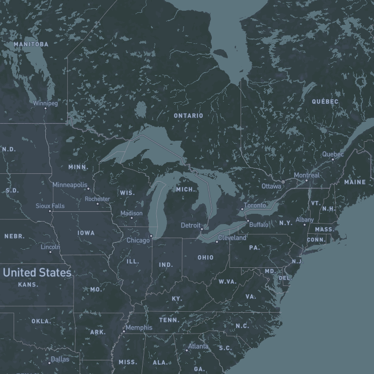
Open the editor, name your project, and pick your basemap. The professional dark navigation map is your starting point — everything else you add on top.
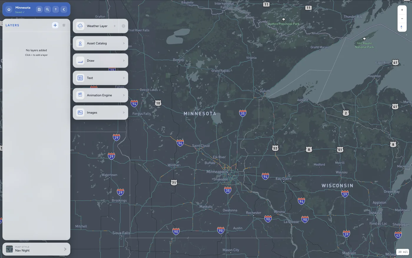
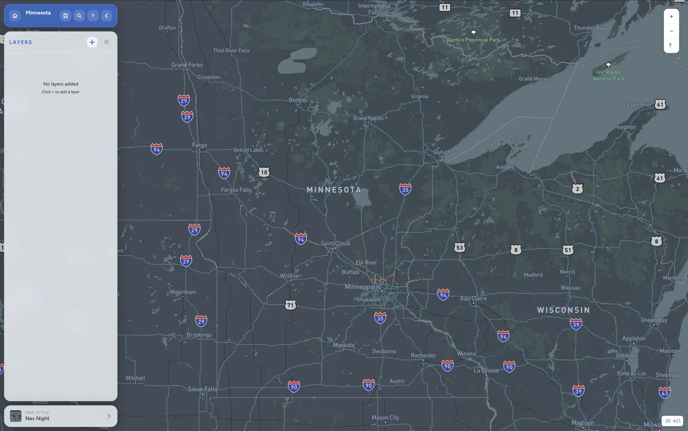
Everything in One Layer Picker
Click + to open the layer panel. Add live weather data, draw annotations, drop in images, type text labels, or open the animation engine — all from a single menu.
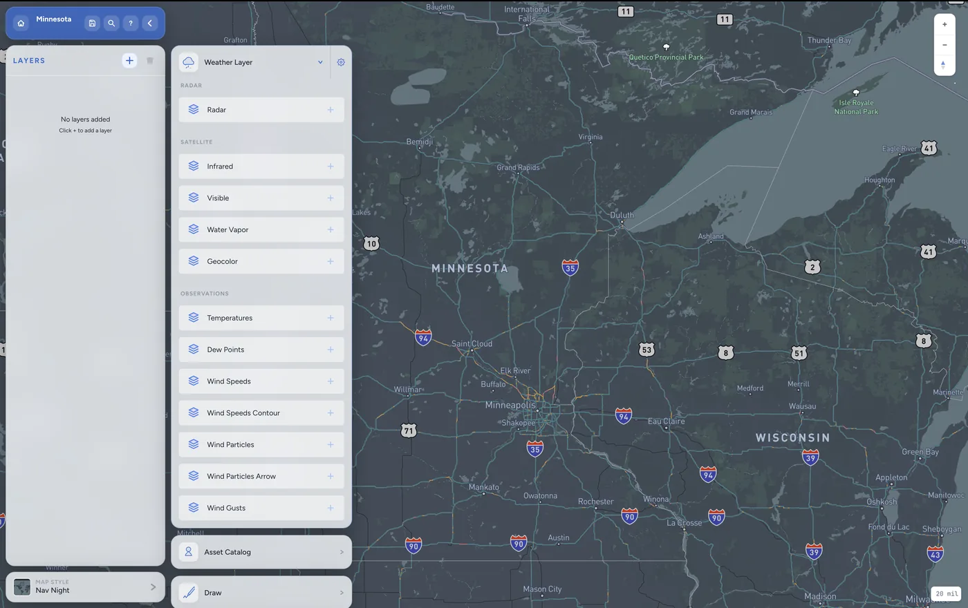
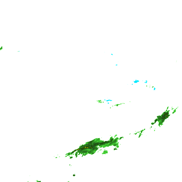
Dozens of Real-Time Layers
Choose from a full library of live weather data: Radar, Satellite (Infrared, Visible, Water Vapor, GeoColor), and Observation layers including Temperatures, Wind Speeds, Dew Points, and more.
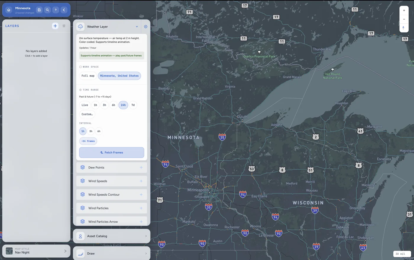
Past, Live, or Future — You Decide
Each weather layer is fully configurable. Set your time range from live data to 7-day forecasts, choose the update interval, and fetch exactly the frames you need for your animation.

Tell the Story With Your Own Graphics
Overlay your weather data with professional annotations — arrows, polygons, text labels, and meteorological symbols like cold fronts. Every element lives on its own layer for full control.
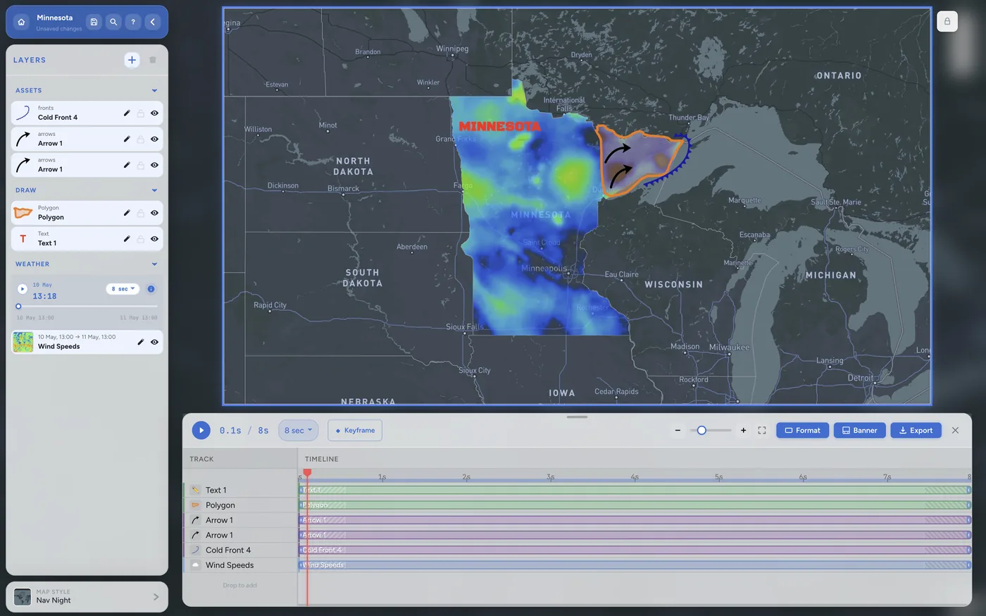
Keyframe Timeline, Production-Ready Output
Drag your layers into the timeline, set keyframes, and preview the full animation. When it looks right, export as PNG, JPEG, or MP4 video — ready for broadcast, streaming, or social media.
Simple, Transparent Pricing
Choose the plan that fits your workflow. Start free, upgrade when you're ready.
- Basic map layers
- Standard export (720p)
- Community templates
- Custom branding
- HD export
- All map layers & overlays
- HD export (1080p + MP4)
- Custom branding & logos
- Priority support
- No watermark
- Everything in Professional
- 4K export
- Team collaboration
- API access
- Dedicated account manager
Ready to Upgrade How You
Deliver Weather Content?
Whether you're building visual stories or powering live broadcasts, our platform helps you move faster, look better, and stay in control.